


Departing Blacks Beach, Mackay
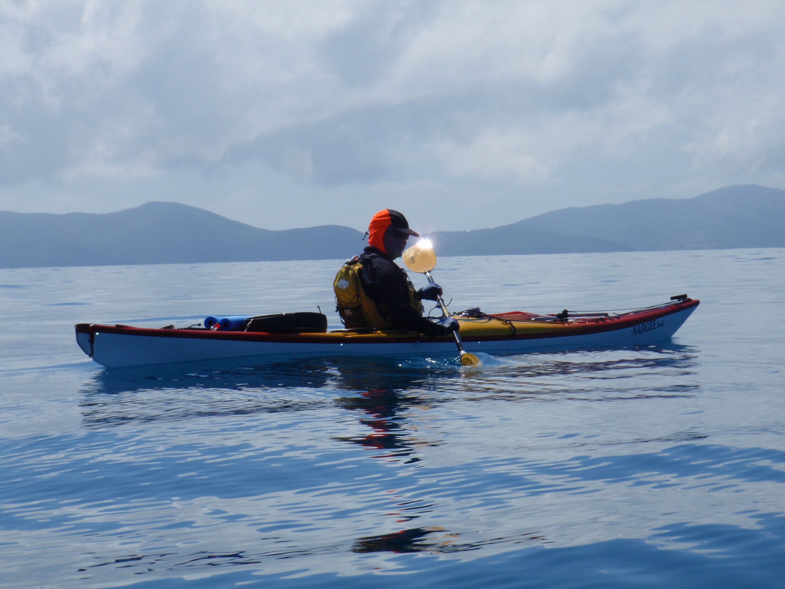
Raia Wall - Nadgee Solo
Neil Brenton - Nadgee Solo
Note on changes since 2009:
This trip was undertaken in September 2009. The aim was to paddle from Mackay to Bowen - taking our time and having a good look around. with Corfelt’s “100 Magical Miles” as inspiration. Since that time most of the resorts where we topped op our water supplies are now closed due to cyclones and the economic times (only Hamilton Island still remains of those visited). We carried 2x 10L & 1x 6L MSR Dromedary bags and a 3L Camelbak each.
We used our own kayaks, but there is also Salty Dog Sea Kayaking who operate out of Shute Harbour - they conduct tours and hire kayaks for trips starting and ending at Shute Harbour. Scamper is a water taxi that can conduct drops of kayaks, food and water.
Since our trip, available campsites may have changed - some have been added and some may no longer be available - see Queensland National Parks website for information and campsite bookings. More walking tracks have been added on Whitsunday Island.
As I arrived at Mackay airport, I was met by Neil, who greeted me with “The weather looks just right - let’s launch tomorrow”. It did look good – the view from Blacks Beach Caravan Park out to Keswick and St Bees Islands looked almost flat, even with the mild afternoon sea breeze and we could see whales spouting out toward the island.
We’d allowed a day in Mackay to get any last minute items, but Neil had already taken care of that, so we decided to go for it a day early.
St Bees Island – Day 1
Arising with the sun, it took a couple of hours to get ready, including satisfying the curiosity of backpackers and passer-by’s, so we didn’t actually launch until 0830, just before the tide was due to turn. Mackay has tides up to 6m range, but we were departing during a time of neap tide and the range was less than 3m, so the ebbing current had minimal effect.
The day was warm and windless. We expected to take around 5 hours for the crossing, passing up the channel between St Bees and Keswick, then around to the campsite (we took 4 ¾hrs to paddle 32km), so we paced ourselves and had hourly food and water breaks. A whale spouting over towards Cockermouth Island, but drawing gradually closer, was an interesting distraction.
The sea stayed flat all the way and eventually we reached the channel – the occupants of Keswick had some pretty nice real estate, but St Bees is basically National Park and is home to a koala colony. We didn’t hear any koalas while we were there so they must live elsewhere on the island.

High tide at Blacks Beach
Glassy seas crossing to St Bees
We did see a number of goats, and were greeted by a dead goat carcass in the camping area on arrival. The campsite left a bit to be desired, being taken over by spiky weeds and festooned by toilet paper from a whole roll carelessly left behind. We picked a sandy area overlooking the beach but better spots may have been behind the dry creek.
Cockermouth Island – Day 2
Leaving at 0740 for the 17km paddle further NW to Cockermouth, we had a slight headwind. Aiming for a nice sandy area at the head of a bay, we soon found that even an hour after high tide the way was blocked by exposed reef flat, so we went around and soon found ourselves racing the fast-falling water. The camping area is surrounded by a broad reef flat and is exposed from mid-tide. We reached the beach with just enough water to protect the gel coat!
The campsite is basic (no facilities) but very scenic – it would be worth staying here more days than the single night we spent. The afternoon NE sea breeze sighed in the casuarinas and at least 8 whales frolicked offshore during the course of the afternoon.

Sunset from our camp among the casuarinas on Cockermouth Island
Carlisle Island – Day 3
Following a trend of leaving even earlier, we departed at 0715, in order to travel before the predicted NE breeze. There was very little wind and we reached Brampton Roads (the channel between Brampton and Carlisle Islands) just after the tide began to ebb. A strong current was sweeping past the island so it was preferable to aim straight for the channel – as it was we had paused to take in the view at the wrong place and realised we were getting swept away from the channel.
Brampton Roads had a lot of coral just inside the channel, turtles and a Long Tom fish that leapt a good 3m in the air in pursuit of a smaller fish. We reached the campsite in 2hrs (13km), located opposite Brampton Island resort. It is the Taj Mahal of national park campsites, with a shelter, many tables, a tank (presently unconnected & empty), gas BBQ (no gas) and toilet tucked away behind a big scrub turkey mound. The snorkelling in the channel was interesting – the coral had long since made way for sea weed and there were a large number of very spiny sea urchins – not to be comfortably undertaken at low tide. The view north to the Smith Group, over turquoise seas, was glorious and swimming off the sandy beach a delight.
The tide went out and exposed a long curved sand flat, along which we strolled with our empties to collect water from the resort (I phoned ahead to organise this the week before). More relaxation ensued and a magnificent sunset before an early night.
View across to Brampton Island

The tide goes out a long way!

Another amazing sunset from the shelter!
Goldsmith Island – Day 4
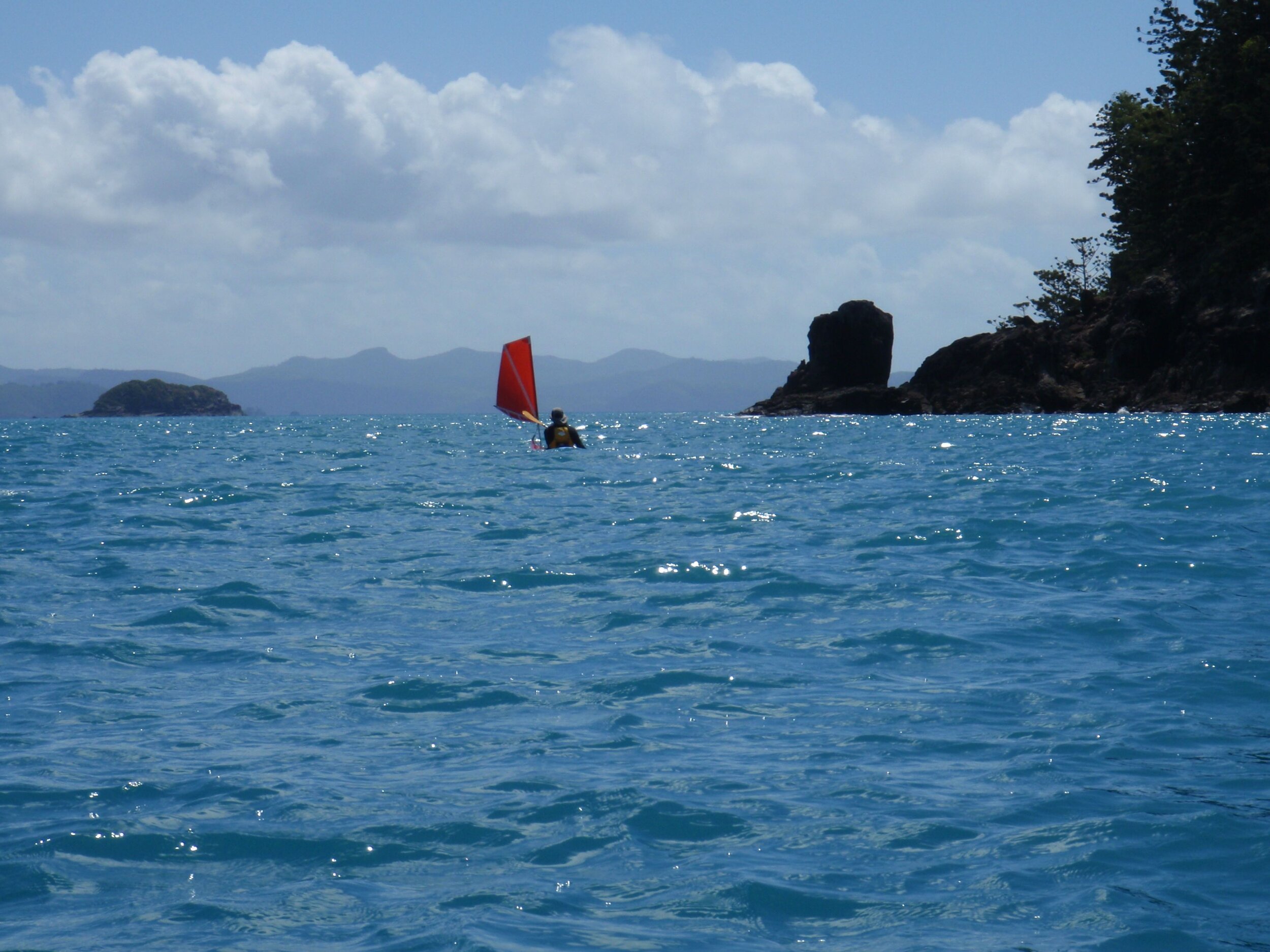
With the high tide occurring a bit later each day, we left as the tide was still rising (but not too far out), resulting in a slight wind-against-tide effect, and we finally had a southerly wind and were able to use the sails for the first time (<10 knots ESE). We paddled out to an unusual formation called the Thumb and Fingers, which looked a bit like the Opera House. After the tide turned the seas flattened out, just before we reached the channel between Goldsmith and Linne islands.
We were expecting some current here as the charts warned of tidal eddies, and as we approached the far end of the channel we could see some white water on what had been otherwise flat seas. Quickly packing away the sails, we cautiously approached and realised we had tidal overfalls – standing waves breaking back towards us (into the current). We skirted through the lowest part of this and shot out the end of the channel doing 6 knots, while just paddling enough to point in the right direction! The water was swirling and there were big areas of upwelling.
Around the corner in Roylen Bay, the camping area had a view over another beautiful turquoise sea. Parks had recently mowed a number of clearings in the tough grass for campsites and a track round to the toilet (festooned at night by great big orb-weaving spiders, positioned at head height), but the table promised in the brochure had disappeared. Soon the skies clouded over and we had a couple of hour’s rain and winds gusting down through the gap in the hills behind us. Several yachts returning from Race Week made a run for the shelter of the bay.

Sailing past Thumb & Fingers

Sailing the Smith Group

Storm coming through & sheltering yachts
Thomas Island – Days 5 & 6
The weather forecast predicted increasing winds over the next few days so we decided to forgo the rest day on Goldsmith and make a run for the next group of island – the Lindeman group. We departed to cloudy skies and a 10 knot SE wind, and the clouds soon started piling up behind us. The wind began to freshen as we passed the cliffs of Silversmith Island.
Picking up the pace we made a run for Thomas Island and landed at Naked Lady Beach after a very fast last 5km. The clouds parted around us but the winds continued to build, so we ended up spending 2 nights in this former camping area. A large amount of very convenient driftwood planks made handy furniture, but also attested to this beach’s slightly exposed position and we watched the whitecaps marching past the entrance to the bay.
With the storm past, we went for a swim – standing in the water Neil noticed a ropy structure and wondered why someone had left behind a perfectly good anchor and chain. As he reached down I called out “Don’t touch that!” allowing the large stingray, whose tail he was about to grab, to escape. Every time I went for a swim that ray was there, turning round and peering at me with little beady eyes.
The tide fell to expose an extensive reef flat over most of the beach. Big black sea slugs abounded and schools of little fish made patterns as the were pursued by bigger fish.

Landing at Thomas Island

Lurking stingray

Really big sea slugs
Lindeman Island – Days 7 & 8
After 2 nights the forecast predicted that the winds would return to their more usual 10-15 knot SE, and indeed the caps seemed to have dropped a bit. We ventured out of the bay and into seas up to 1.5m and capping. This was mainly in the vicinity of the first point on the south side of Thomas Island, after that the seas were smaller and the wind dropped right off. Brown gannets hovered overhead and plunged down into the schools of fish as we passed south of Keyser Island.
We sailed and surfed the following sea around the bottom of Shaw Island, then around to the southern side of Lindeman Island where the Club Med resort was located. The friendly water sports staff met us on the beach and we collected some more water and declined the invitation to stay for lunch, feeling a bit untidy and underdressed.
A fast run with the tide up the west side of Lindeman Island brought us to the campsite at Boat Port. There was a tide race on the NW corner of the island that gave us a good ride. This bay is the original landing used during the construction of the resort in the 1920’s – materials were offloaded here and carted across the island. The roads remain as a system of well-maintained walking tracks.
Boat Port camp has a wonderful outlook across to Little Lindeman Island and Pentecost Island (see banner pic above). The serenity is broken only by airplanes flying over to land on Hamilton Island. We arrived at lunchtime, a couple of hours after high tide, and were resting at the shady table when a well-exercised couple ran up and looked slightly surprised to find campers there. We found that people staying in resorts don’t usually realise that camping is possible on the islands and that we were holidaying on $5 per night!
Next day we took to the walking tracks in the cool of the morning, walking up Mt Oldfield to take in the 360 degree views, then spent the afternoon swimming and relaxing with a book.
Rounding the western side of Lindeman Island

View from Mt Oldfield

Packing on the rising tide
Whitsunday Island – Chance Bay – Days 9 & 10
By now the high tides were occurring later in the morning – nearly lunchtime, so the carry down to the beach was a bit longer than previous and we were trying to judge where the water would reach in the time it took us to pack. As it was the kayaks had just started to float as we were sealing up the hatches and the banjo sharks (rays) scattered as we paddled off.
Out by Pentecost Island the turtles and dolphins were clearly visible in the glassy seas. We crossed the strait between the Lindeman group and Whitsunday Group and turned past some smaller islands towards Hamilton Island. The further north we travelled the closer the islands appeared and the busier the seas became. As we approached Hamilton Island a noisy jet-ski tour sped past us and we decided to leave the sails up even though we had just passed into the lee of the island – we wanted to be as visible as possible.

Mirror seas off Pentecost Island

Let’s not mix our kayaks up with this hire fleet on Catseye Bay!
Rounding a final headland the hotel towers of Hamilton Island reared up ahead of us like a mini-GoldCoast, in stark contrast to the islands we felt we had almost to ourselves for the past week. Landing in Catseye Bay amid some rather slimy seaweed, we changed into dry clothes and headed into the resort. The main purpose was to wash our clothes, ourselves and collect some more fresh food, since we had by now made a bit of space in the kayaks.
The shops and laundromat are on the marina side of the island and we caught the free shuttlebus, getting a tour of the resort, before realising it was more direct to walk. After the washing, we had lunch out but soon departed – it seemed so crowded after our deserted isles and we didn’t want to leave our kayaks unattended on the busy beach for too long.
We crossed to the Whitsunday side of the channel, initially with a tail wind, but that soon fell and a NE sprung up as we crossed Turtle Bay. The last 5km we spent punching into a head wind, finally round the point into Chance Bay mid-afternoon. A large bombie off the point moved as we skirted it, revealed to be one of the largest turtles I’ve ever seen!
Chance Bay is another idyllic setting; in fact I think it was the most attractive of the bays we camped on, closely followed by Cockermouth Island and Maureen’s Cove. The snorkelling is not a patch on Maureen’s though – Chance Bay is a sandy beach, but is good swimming and access at all tides, and is not a long carry for the kayaks.
The campsite is up on the hillside above the beach – great view but the first step is a doozie! Don’t hang your washing over the railing – the bull ants love damp clothes.
The next day we decided to spend another day at Chance Bay – up until then we had been slightly ahead of our itinerary, but coming into busier campsites it seemed a good idea to be actually on the day we were booked for. We also were suddenly reluctant to move into the busier areas and relished our peace and quiet. At 0700 this was suddenly disturbed by the arrival of Scamper, the inter-island ferry, who offloaded a small excavator and work crew of two men. They moved the excavator up above the tide line then inexplicably sat down for the rest of the day.

Chance Bay

Planes & boats - getting a bit busy
From then on the beach got busy – float planes and yacht tenders landing, plus a couple of tour boats. It seems that Whitehaven Beach – just a couple of kilometres away over the ridge, was a bit choppy and these planes and boats couldn’t land. People kept wandering in to camp and asking us if this was the way to Whitehaven Beach (“No”). Later, after they had all gone, we wandered up to the work crew and asked what they were up to – it turned out they were putting a track through to Whitehaven!
Whitsunday Island – Whitehaven Beach – Day 11
This was the morning we were to paddle Solway Passage, a strait we had heard described as one of the most daunting of the Whitsundays, so we approached it with some trepidation. The forecast was for north easterlies and the tide was flooding from the north until 1230, so in the morning we would have both wind and tide against us, but by the afternoon the wind would be stronger and the tide would be against the wind. Deciding the morning to be most favourable, we departed around 1030, as the current would be decreasing. We snuck around a small island past a delightful little secluded beach, and entered the Passage, keeping as close to the side as possible. We must have picked up an eddy as we shot through against both current & 10 knot breeze, going almost as fast as the small yacht motoring in the centre of the passage!
It was choppy around the corner, then we were around and arriving at busy Whitehaven Beach. We arrived right in the middle of a departing kayaking school group, of about 14 people, mostly in doubles.

Solway Passage - not so bad!

Sun setting over Whitsunday Island
We found a good campsite with a view of the beach and settled in to watch the passing parade – Scamper dropping off and picking up people, and later a large kayak club group arrived and camped further down the beach.
Hook Island – Hook Island Resort – Day 12
Whitehaven Beach at dawn was much more picturesque and tranquil than on the previous day. As we packed the kayaks we were approached by a women who had hired a sit on top and had been told she could paddle anywhere on it. She wanted to paddle to Chance Bay but seemed unsure of where it was. We explained the unsuitability of attempting to take a sit on top the 8km to Chance Bay through Solway Passage. Apparently we were not the first kayakers to tell her this and she was being picked up that afternoon so hopefully she was convinced.
A light tailwind picked up and we sailed along Whitehaven over crystal clear waters towards Hill Inlet. As we neared, it became apparent there was several boatloads of backpackers dropped off there to relax on the beach and walk up to the lookout. Fortunately they were not in the water, for as we approached the shore several dozen stingrays scattered. More stingrays in one place than I had ever seen.

Relaxed sailing along Whitehaven Beach

Hill Inlet
We landed near a group of young men, and after chatting about what we were doing we persuaded them to help move our kayaks up away from the rising tide. The view from the lookout was amazing and well worth the short walk, though I felt very overdressed (and a bit warm) in my long sleeved paddling gear next to all the shirtless and sunburnt northern hemisphere backpackers – I got a few funny looks!
On returning to the kayaks it was obvious that we has overestimated how high the tide would come – the kayaks were about 80m from the water and our helpers had disappeared. The wheels came into their own on the ‘reasonably’ flat and firm sand and we were soon underway again.
Paddling along the eastern side of Whitsunday Island we again caught up with the school group and stopped for a chat. Then at the top of the island we came across a trio of Western Australians in hire boats who were missing their own boats and having trouble making way against both the tides and the winds.
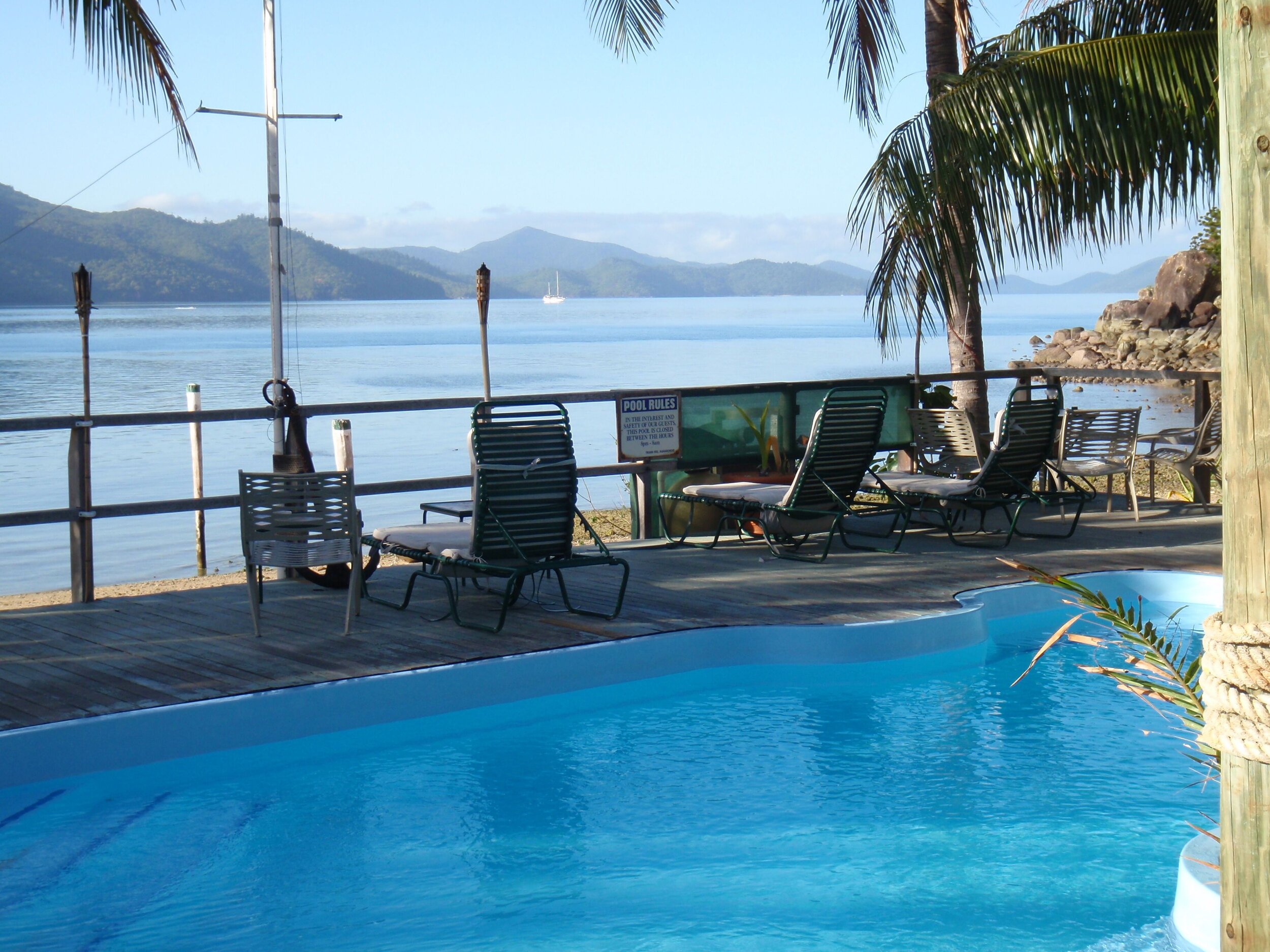
Passing through Hook Passage with the last of the flood tide we pulled into the low key Hook Island Resort and took a ensuite room as a break from camping. There we enjoyed a lunch and dinner that had not previously been dehydrated, plus a couple of beers. The snorkelling in front of the resort has some very nice coral but is not a patch on our next stop.
Hook Island Resort
Hook Island – Maureen’s Cove – Days 13 & 14
We had a leisurely start the next day, in anticipation of the breakfast that was included in our room rate, and supposed to start at 0730. We didn’t want to hang around too late as slack water in Hook Passage was at 0700, so the longer we delayed the stronger the current against us. The staff however, seemed to have other ideas and was clearly keeping ‘island time’ – the mechanic was up but the house staff had had a late night and was sleeping in. Perhaps people wanting a 0730 breakfast were unusual! Eventually he appeared, we ate a hearty breakfast – cereal, fruit, yoghurt, toast – makes a change from a small bowl of porridge!
On our previous trip to the Whitsundays 4 years ago, a frisky little breeze behind us caused us to reach the Pinnacle before slack water and we were committed to rounding it with steep waves standing up behind us – a scary experience to the novices we were then. This time was vastly different – a calm day, no waves, and we were able to play in close to the rocks and pass between them where there was a tiny ‘horizontal waterfall’ only a few centimetres high.
We spent some time checking out the corals in the next few bays before coming around into Maureen’s Cove, where we expected to find VSKC members the Woollards, Chicks and Sharps. We had been exchanging Spot announcer signals with Peter Sharp and felt we would be expected. The camp was very quiet, no-one visible, just the 3 double Sea Bears. Neil went up the beach to the camp, and greeted the group who were engrossed in lunch preparations – and was surprised that Peter flat out didn’t recognise him! Admittedly he was sporting 2 weeks growth of face fuzz and was about 4kg lighter but still!
We spent an enjoyable 2 days with the group, snorkelling, reading and enjoying the sunset over snacks and scotch.

Rounding the Pinnacle in perfect conditions

Rock formation “The Woodpile”
Snorkelling the northern side of Hook Island
Hook Island – Steen’s Beach – Days 15 & 16
With the forecast again predicting strengthening SE winds we moved around to Steen’s Beach the next afternoon (a huge distance of 4km), so that we would have a good view of the crossing to Armit Island. We left in the afternoon as this was when the tide would be approaching high – the reef at Steen’s is not passable when the tide is too low.
By the afternoon the wind was quite brisk and coming around one point a gust nearly blew the paddle out of my hand. With the forecast sounding about the same for the next day, it was looking unlikely we would be departing yet as we had a 20km crossing between Hook and Double Cone Island and didn’t fancy doing it in +20knot winds.
This indeed was the case so we stayed put, to be greeted by the Woollards and Chicks the following afternoon (the Sharps had left 2 days previously to go to Curlew Beach).
Steen’s Beach sunset, looking towards Gloucester Island
Saddleback Island – Day 17
John, Annie, Tony and Jill got up extra early to make sure we did in fact leave and went in our promised direction. The tide was almost high and the flood tide carried us out of the channel, then it turned and we had both wind and tide from the SE. It got a little bit lumpy out in the channel but we kept on course for Double Cone and eventually were able to rest in the lee of the island.
The last 7km into Armit Island were less lumpy as the water was a bit shallower. Once again the ‘shortcut’ had closed off a couple of hours after high tide and we had to go the long way around. We arrived before 11am, having done nearly 30km. The campsite is located in a rather picturesque bay with small knolls of soft corals, though the campsite itself is quite bare – quite a dry looking island and the advertised toilet had disappeared. We decided to have lunch early so we sat and ate under a shady tree and contemplated the mainland, which was now quite close, and how we had nearly reached the end of our journey.
Saddleback Island is situated around a peninsula at the eastern approach to Gloucester Passage. The campsite is situated on a small point on the southwest corner of the island and the “100 Magic Miles” book describes it as possibly containing a large number of death adder snakes.

Armit Island - nice beach, but arid camp

Final sunset over the mainland, from Saddleback Island
As we approached it a reef of spiky rock stretched out towards us. It was low tide and still early afternoon so I suggested that if it wasn’t landable on the other side we might perhaps go on. Neil looked a bit doubtful at this suggestion after 44km, but fortunately a nice sandy/coral gravel beach greeted us. The campsite had a nice table under a big shady tree, with views across to Gloucester Island. No death adders disturbed us.
Bowen – Day 18
Our final day and we were keen to get going but regretful to be finishing at the same time. The flood tide was either assisting us in Gloucester Passage or neutral and we sped towards the final open crossing.
Bowen is a very low-lying town and is located behind an island, so it was impossible to see 20km out by Gloucester Island. We navigated westward by compass across a fairly shallow body of water and even when we got close were still debating the correct way through. Not until you get around the island can you actually see the town, though some of the outlying ‘suburbs’ are visible to the north and south.
We came in at the marina, which has the patch of sandy, firm mud closest to Harbour Lights Caravan Park. Neil deployed the wheels again and I walked up and booked us into a cabin. We brought up the other kayak and unpacked, then enjoyed a welcome shower and a big pub hamburger, before Neil caught the bus back to Mackay to collect the car – he was back at Bowen by 730pm. Two and a half weeks and nearly 300km of paddling retraced by a 3 ½ hour bus ride!

The route - 13 day’s mostly leisurely paddling
Planning, Logistics and other important matters
The Whitsundays are a very accessible area for kayaking and can be done as a longer trip like this, or in a very leisurely fashion – you can even get dropped off by Scamper to avoid crossing between islands and can organise food drops.
Time of Year
We left at the end of August and finished in mid-September. This is probably the most forgiving time of year – it was warm, the trade winds are dropping off, but it is not yet stinger season (starts in October) and the bugs weren’t too bad – we had sandflies and mozzies but not march flies.
Note: Since this trip the sharks in Cid Harbour (which we didn’t visit) and Irukandji jellyfish have become an issue.
Weather
Even with the comparatively mild September conditions, you still need the means to forecast the weather. We took a sideband radio and listened to the scheduled weather forecasts each day. Telstra phones worked at most campsites (not on the far side of Whitsunday & Hook) and provided a backup if we needed a forecast at unscheduled times.
(How times have changed! Now we use Meteye - coverage still not available on the far side of Whitsunday & Hook Islands though.)
The dominant weather pattern in ‘winter’ is SE winds, but by September there are some days of NE winds and generally the winds are stronger in the afternoon. Wind direction depends on whether there is a low pressure trough passing or a high pressure ridge extending from a High over the southern states. Most days we were on the water fairly early when the winds are least – between about 0630 and 0745.
Route Planning and Tides
When planning when to leave and when to paddle the tides are very important – make sure you start with the predicted tides for Mackay / Shute Harbour / Bowen as they make a big difference to your comfort landing and departing. Ideally you want to travel around high tide so you minimise carrying your gear. Some beaches are not landable at low tide (Cockermouth, Steen’s) and some will involve a long carry (Lindeman, Carlisle). Most paddling days we travelled on average 16-20km, or about 2.5-3 hours, so leaving just before high tide meant landing just after high tide.
The other consideration concerning tides is direction of the current – the flooding (rising) tide flows south, and the tide ebbs (falling tide) towards the north. The tide range is bigger near Mackay than in the north, so the currents can potentially be stronger, though we were in that area when the tide range was at its smallest (neap tides), so currents only became a consideration through passages and around points or when the wind and tide were opposing.
Once I had an idea of when to go, I plotted the route on Garmin’s Mapsource (now Homeport) software and then downloaded the distances and bearings into a spreadsheet. Adding tide times and heights, I could check that the distances and timing were optimum. I carried hard copy laminated charts (with tide info annotated) and Neil had the route and campsite waypoints uploaded to his GPS.
Water
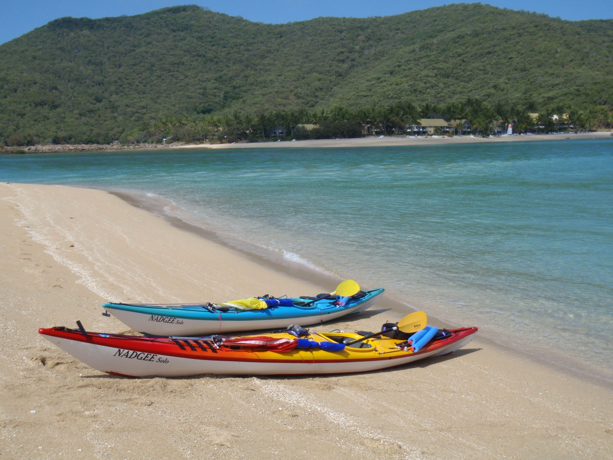
As the weather was warming up we used close to the full 5 litres per person per day. We carried 29 litres each – 2x 10l & 1x 6l MSR bags and 3l Camelback. Carry water as close to the centre of your kayak as possible – I had the 3 litre behind my seat, 10 litres in the day hatch, 6 litres below my knees in the cockpit (secured by bungee) and 10 litres in the front hatch against the bulkhead (just forward of my feet). The kayak (Nadgee Solo) felt heavy in the water but very stable.
We topped up our supplies at resorts – they were all reasonably welcoming to kayakers except Hayman Island who do not want outside visitors. They were not part of our water replenishment plan. In addition, yachties have desal plants on board and will often offer water, and we picked up several litres from departing backpackers at Whitehaven. In all we probably were carrying more weight in water than was necessary in the early part of the trip but felt secure in our supply.
Food
We ate well and never felt hungry, but we did lose a few kilos each (intended!). Aside from replenishing the cheese and tomatoes at Hamilton Island we carried all 18 days food (plus some spares) without a food drop.
Breakfast - porridge with sultanas, but varied on a couple of rest days with pancakes (Shaker mix – just add water), with dried stewed apricots (soaked in water & heated up).
Lunch – 4 VitaWheat biscuits with tomato, cheese and avocado when we had it, and tuna or salmon when we were out of fresh food. Tomatoes last well if they have the stalks still in them and avocados can travel for a week provided they are not squashed up too much!
Dinner – a variety of dehydrated meals, all based around various mince meats (beef, chicken, lamb) with a sauce and vegetables, cooked up at home and dehydrated overnight. Use mince – very important!!! Strips / cubes of meat do not rehydrate well (a bit like the joke about cooking a galah up with a stone – boil until the stone is done then throw the galah away). Bolognaise sauce rehydrates exceptionally well. If you have beans / chick peas allow a bit more time. We usually started ‘soak time’ at around 4pm for 6pm dinner. The meat dish was teamed with appropriate source of carbohydrate (rice, couscous, pasta, mashed potato). Allow about 150 – 200g mince per person when cooking, depending on your size and how strenuous you paddle days will be (we would have been closer to the 150g). We have been using packet sauce bases in some meals but are now tending towards entirely home-made sauces / flavours. Each meal (for 2) was stored in a ziplock bag – use good quality ones else the sharp bits of dried mince tear holes in the bag and at the bottom of your dry bag you will find ‘pot luck’ a mixed bag of your last few days meals!
Snacks – on the water we had a scroggin mix of nuts, seeds and dried fruit (small ziplock bag size – about 140 - 200g per paddling day). For onshore we had a few luxuries – cheese, tinned oysters, fruit leather (home-made). We also had extra dried fruit medley in case we wanted dessert but were seldom that hungry. The big decision was alcohol – we didn’t take any (Really! Truly!). We just didn’t think we could fit it in or would have to sacrifice food or water. We did have a drink at Hook Island Resort and helped out Annie & Jill with their bottles of scotch – a small tipple at sunset. Generally though it was a mostly dry trip, we didn’t miss it and felt very healthy!
Looking after yourself
On any expedition you need to take care that you stay in good shape and are able to complete the trip. Don’t bite off more than you can chew with paddle distances – even if you are on a tight schedule plan your stages so that you have rest days (it is a holiday after all!) and also can make up time if you have to take weather days.
Look after your back – this means around camp and when moving your kayak. The Nadgee wheels are great but if the sand is soft / beach steep you may have to unload and carry some gear. If you have a very heavy kayak such as a hired double you may need more than two people to carry it empty, let alone full. This may determine the minimum size of your group. We also took ‘noodles’ for use as rollers on gravelly beaches – they were useful at Maureen’s Cove and Saddleback Island in particular and helped to protect the gel coat.
Look after your skin – (1) Bugs – protect yourself against march flies, mosquitoes (there was a dengue fever outbreak in Qld that year) and possibly sandflies. Use long sleeves, pants and repellent. Even so I got a few bites but with a daily Telfast I avoided the usual itching.
(2) Plants – there are stinging plants in the vine forests – it is probably better to stay on the tracks or walk on the beach.
(3) Hygiene – you are unlikely to be able to have a freshwater wash often, but there are alternatives. Getting all the bug spray , sunscreen and salt off each night will help keep your skin healthy, avoid chafing and keep your off water clothes & bedding nice for longer. Wilderness Wash in salt water is one method, but you are still salty. I prefer to use those moist towelettes / facial wipes, though they don’t work on hair! The shower at the marina on Hamilton Island was welcome!
(4) Sunscreen & protective clothing – as you would at home.
Booking campsites
The national parks campsites can be booked on line except at that time, for St Bees & Cockermouth Islands – I had to phone up Mackay or Airlie Beach for those. I ended up booking all mine over the phone with the ranger at Airlie Beach. Campsites were $5 per person per night. Except on Hook Island and Whitehaven Beach we had the campsites to ourselves – at the start and end we were a day or so out from our itinerary, but in the busy areas we tried be there on the day we had booked for. This is particularly important if you are in a big group – some school and club groups were travelling with 10 or more people and tended to overwhelm campsites.
From talking to the ranger, their attitude at that time was that if you can’t be exactly where you have booked due to the weather, then that is better than putting yourself in danger. Aside from the guys working at Chance Bay and Whitehaven Beach we didn’t see any national parks staff, and those weren’t checking permits, but there were rangers about as somebody was trimming the grass and topping up the toilet paper at various sites (& doing burning off at St Bees the week after we were there).
Resources:
Corfelt, D. 2004. 100 Magic Miles of the Great Barrier Reef: the Whitsunday Islands (7th Ed.).